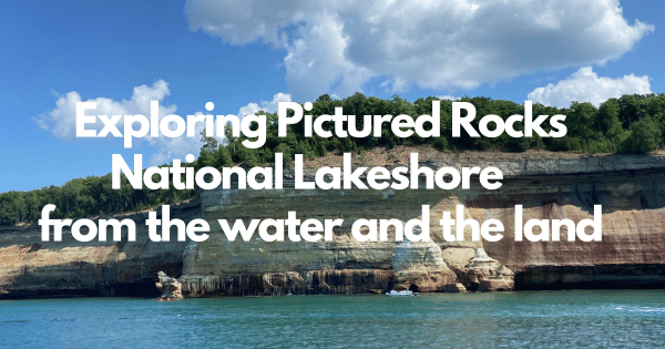
Exploring Pictured Rocks National Lakeshore from the water and the land
written by Nancy Carter, Making My Own Lane
Exploring Pictured Rocks National Lakeshore, Upper Peninsula Michigan
Pictured Rocks or Painted Rocks in the UP, or Upper Peninsula of Michigan gets its name from the stunning, colorful sandstone cliffs that reach up to 200 feet above the southern shores of Lake Superior.
They were sculpted by nature into sea caves, arches, and formations resembling castle turrets and human profiles.
It holds the designation of the first National Lakeshore, established in 1966..
Pictured Rocks is not a National Park, but a National Lakeshore. At the same time, the boat tour is not run by the National Parks Service - therefore, you can’t use your national park pass for a discount.
Where is Pictured Rocks?
It is located between Munising and Grand Marais. When I visited, I stayed at the Munising KOA, about a 30 minute drive to the park and boat tour.
What is the best way to see Pictured Rocks?
The best way to see 20 miles of the 42-mile shoreline is by boat, and I decided on a 2-hour boat ride. Because this is a larger boat, it is more likely to run even when it’s windy with small craft advisories and other options may be cancelled.
The guides will point out many of the different formations and points of interest and talk about the history of the park and the ever changing landscape. I chose the Spray Falls Cruise.
Get there about 45 minutes before the boat leaves so you can get a seat on the left-side of the boat for the best views of the shoreline. But you will see everything from the right-hand side of the boat on the way back, without as much narration.
I booked my boat tour about a month in advance. There were some people at the campground that were not able to book a cruise during their stay once they arrived at the park, so you may want to consider booking early to guarantee you a spot on the boat.
There was plenty of parking close to the dock, and even some areas for small RVs to park.
I opted for a seat on the second level, while most people rushed up to the top level.
What gives the rocks the red, orange, brown white and even green and blue colors are the different mineral deposits of iron, copper, manganese, and limonite as the water drips between the cracks and crevices in the rocks.
Rock arches and sea caves that would be fun to explore by kayak, and the clear, turquoise water color makes you feel like you are in the Caribbean.
What do you see on a boat tour of Pictured Rocks?
Some of the things that we saw on the boat tour were
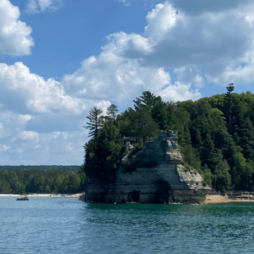
Miners Castle, considered to be the most famous of the rock formations in Pictured Rocks National Lakeshore. In 2006 one of the two turrets eroded and fell into the lake, leaving just the one turret you see here.
Bridalveil Falls, which was only a trickle when I saw it, but it is much larger in the spring.
Sea Caves of All Colors. As the tour went on, the afternoon sun hit the rock formations and created even more beautiful colors.
Rainbow Cave, where it always looks like it is raining in the cave. They say if you catch the afternoon light just right, you may see a rainbow here.
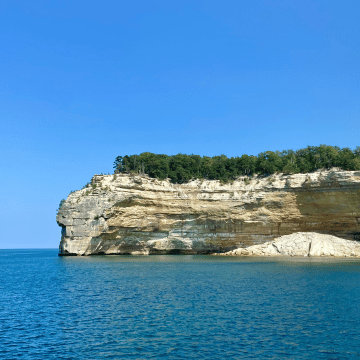
Indian Head named after what some say this massive rock formation resembles.
Grand Portal, with its massive 300 foot archway before a partial collapse in the early 1900’s.
Battleship Rocks that resemble 3 battleships headed out to sea.
Chapel Cove where we were able to enter the cove so that you are surrounded on 3 sides with tall colored rock formations, clear, turquoise water below and blue sky above
Chapel Rock with its single white pine that grows on the rock that is about 250 years old. If you look closely, you can see that the roots of the tree stretch back to the land. At one time there was an archway that connected the rock to the mainland, but it collapsed at some point in the 1940s.
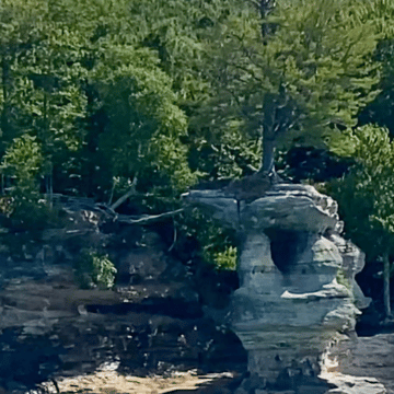
Spray Falls, best seen from the water with a shipwreck from 1856 at the base of the falls.
Lovers Leap - The legend says a Native American woman was heartbroken when her lover did not return from a hunting trip, so she flung herself off the cliff. The water under the cliff is less than three feet deep.
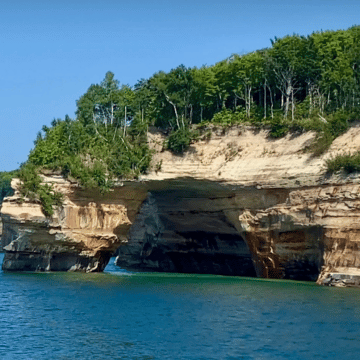
Painted Coves with its colorful sandstone cliffs that stretch along about 15 miles of coastline.
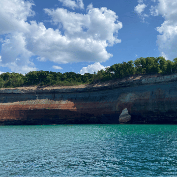
The East Channel Lighthouse located on Grand Island.
Hiking Miners Castle Trail
Miners Castle formation is the only cliff point accessible by vehicle, where you can drive down a road that will put you within a 10 or 15 minute hike of the Castle and beautiful views of Lake Superior.
Along the way you will also find the 50-foot drop of Miners Falls. From here you can continue walking down to the popular Miner’s Beach, where you can swim in the waters of Lake Superior.
I was able to stick my toes in the water of the 5th and final great lake on my journey to visit all of the Great Lakes.
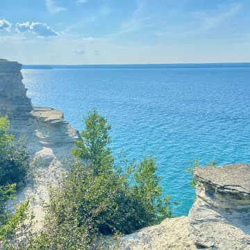
What else is there to see and do in Pictured Rocks?
There are a few other areas and waterfalls you may want to check out, if you have the time, like Munising Falls.
Au Sable Point LightHouse, which is open to the public.
And Grand Sable Dunes, a file-mile long sand slope as much as 275 feet above Superior Lake on the eastern edge of the park, where they used to send the freshly cut white-pine logs down from the top of the dunes to awaiting freighters below, and another spot, like Sleeping Bear Dunes, where you can run down to the bottom, and then climb the dunes back up to the top.
You can also kayak for a closer up view of the rocks or take a glass bottom boat for an up close view of two shipwrecks.
There are also over 100 miles of hiking trails with hikes varying from less than 1 mile up to 42 miles on the North Country National Scenic Trail.
Is it worth going to Pictured National Lakeshore?
YES! I really enjoyed the boat ride. People have asked me if I get lonely doing things by myself, but I have found that on almost every excursion, there is at least one other solo traveler. Somehow, we find each other and enjoy the excursion together.
The beauty of the shoreline and the miles of trails that you can explore make this a must see area in the Upper Peninsula of Michigan.
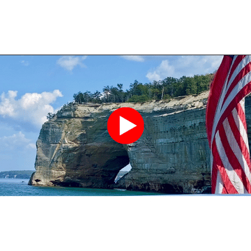
Just like the best way to experience Pictured Rocks National Lakeshore is by boat, the best way to experience the boat tour is to watch this video below!
If you have any comments, suggestions or questions about Pictured Rocks National Lakeshore, or if you can subscribe at makingmyownlane.com for my newsletter or notifications about when I publish a new video or blog post.
Thanks for joining me as I continue Year 2 of this full-time RV life.
Subscribe below for updates as we travel and continue to enjoy and learn more about life on the road.
Thank you for subscribing!
Have a great day!

Hi there! I'm Nancy.
In 2023, I ditched my heels for hiking boots, sold my house, and decided to travel the US full time in my 2005 Lazy Daze Class C RV.
I love to share the places I travel to and what it's like to live in an RV full-time.
If you have ever thought about hitting the road and traveling in an RV, either in your free time or full time, you are in the right place!
Follow along for weekly blog posts about my adventures as I travel the US with my two dogs, Rufus and Willie, and my cat, Katie.
